Tuolumne County · California Historical Landmark No. 123
Columbia
State Landmark · Columbia · Tuolumne County, California
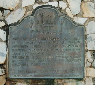
What the marker says
One of the best preserved of early mining towns and known as “Gem of Southern Mines”. Gold discovered through cloudburst 1850. Population grew to 6000 in six weeks. Governor Earl Warren signed bill at Columbia July 15, 1945, creating Columbia State Park. Erected by Department of Public Works – Division of Highways. (Directional plaque for California Historical Landmark No. 123, “← 2 Miles.”)
The record
| Marker family | State Landmark |
| Landmark number | No. 123 |
| County | Tuolumne County |
| Place | Columbia |
| Location | On Golden Chain Highway (State Highway 49), on the right when traveling south, west of the Parrots Ferry Road intersection; at or near 11225 Golden Chain Highway, Columbia |
| Coordinates | 38.013433, -120.397650 |