Placer County
Emigrant Wagon Route
County / Local · Soda Springs · Placer County, California
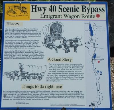
History. After the emigrants had successfully negotiated Donner Pass, they rested in Summit Valley (Van Norden now). They grazed the stock, drank their fill of the pure water and rested. The trip had been exhausting and dangerous but now they were in California and ready to undertake the final part of their trek. It was all downhill now (well almost all downhill). They had made it to California. Emigrants headed up from Summit Valley and right here they turned right, or west. The wagons rolled along what is now Pahatsi Rd. past Kidd Lake, Cascade Lake, and others until they got almost to Devil's Peak. There they turned north and headed downhill to the Yuba River, Hampshire Rocks, and Big Bend, their next resting spot.… Erected by Donner Summit Historical Society. (Marker Number 12.)
Partial text — the full plaque text has not been transcribed in full.
The record
| Marker family | County / Local |
| County | Placer County |
| Place | Soda Springs |
| Location | On Soda Springs Road near Pahatsi Road, on the left when traveling south; at or near 7151 Soda Springs Road, Soda Springs CA 95728 |
| Coordinates | 39.312883, -120.381233 |
| Same-site note | Stands a few steps from the Truckee Trail - Leaving Summit Valley marker (m=149586); distinct panels, not duplicates. |