Tuolumne County · California Historical Landmark No. 419
Jacksonville
State Landmark · Chinese Camp · Tuolumne County, California
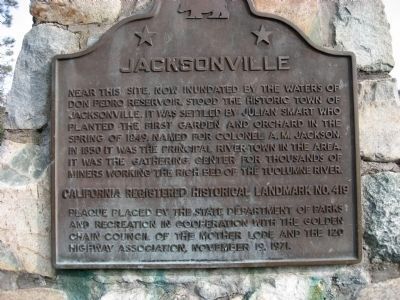
What the marker says
Near this site, now inundated by the waters of Don Pedro Reservoir, stood the historic town of Jacksonville. It was settled by Julian Smart who planted the first garden and orchard in the spring of 1849. Named for Colonel A. M. Jackson. In 1850 it was the principal river town in the area. It was the gathering center for thousands of miners working the rich bed of the Tuolumne River. Erected 1971 by State Department of Parks and Recreation in cooperation with the Golden Chain Council of the Mother Lode and the 120 Highway Association.
The record
| Marker family | State Landmark |
| Landmark number | No. 419 |
| County | Tuolumne County |
| Place | Chinese Camp |
| Location | On State Highway 49, on the left when traveling south. 13.8 miles south of N. Washington Street & Stockton Road, downtown Sonora |
| Coordinates | 37.844383, -120.381483 |