El Dorado County
Placerville
Other · Placerville · El Dorado County, California
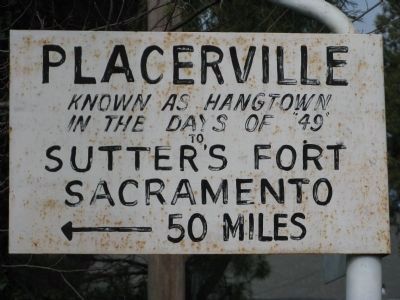
What the marker says
[Marker facing Bee Street] Placerville — Known as Hangtown in the days of “49” — to Sutter's Fort, Sacramento, 50 Miles. [Marker facing Coloma Street–State Hwy 49] Placerville — to — Coloma 8 mi. Where gold was first discovered by James W. Marshall in 1848. Erected 1948. (An El Camino Real bell guidepost placed for the Gold Discovery Centennial; a contributor notes a March 1917 photo already shows the bell, disputing the 1948 date.)
The record
| Marker family | Other |
| County | El Dorado County |
| Place | Placerville |
| Location | At the intersection of Coloma Street (State Hwy 49) and Bee Street, on the left when traveling north on Coloma Street, Placerville CA 95667 |
| Coordinates | 38.731800, -120.806633 |