Tuolumne County
Springfield Cemetery
Native Sons / Daughters · Columbia · Tuolumne County, California
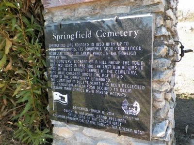
What the marker says
Springfield was founded in 1850 with up to 2000 inhabitants. Its downfall soon commenced, however, owing, in great part, to the foreign miner's tax. This cemetery, located on a hill above the town, was first used in 1852 and the last burial was in 1997. Of the 34 known graves in the cemetery, nine were children under the age of six. Many of the graves are unmarked. The cemetery in recent years has been neglected until Columbia Parlor #258 decided to begin regular maintenance as a parlor activity. Erected 2014 by Grand Parlor and Columbia Parlor #258 Native Sons of the Golden West. (Marker Number 137-08.)
The record
| Marker family | Native Sons / Daughters |
| County | Tuolumne County |
| Place | Columbia |
| Location | On Horseshoe Bend Road 0.2 miles west of Springfield Road, on the left when traveling west; marker is on the left gate pillar of the cemetery, about 100 feet from the road |
| Coordinates | 38.022467, -120.415433 |