Fiddletown Hikes Hiking Buddy's local trail list
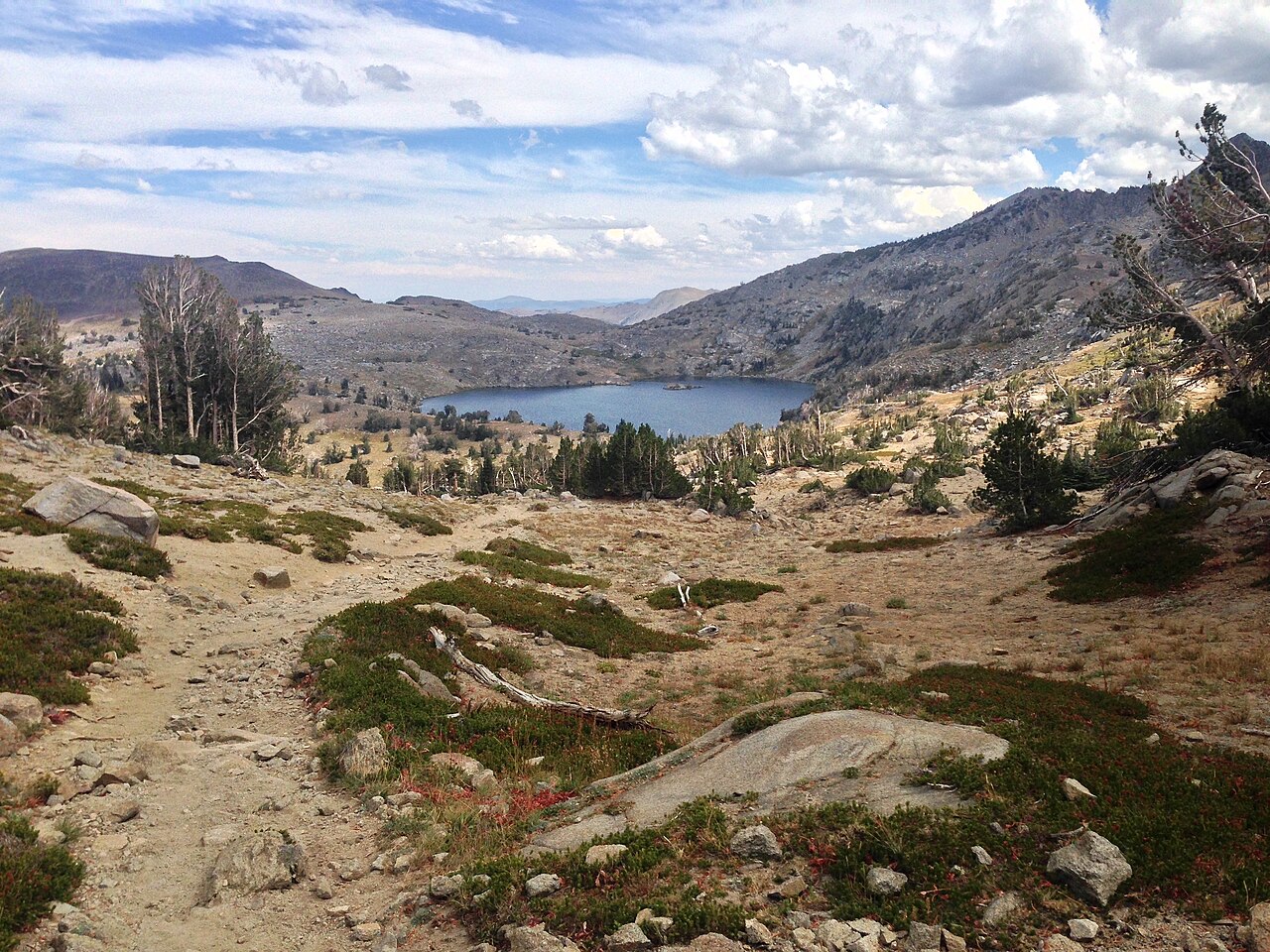
Lake Winnemucca in its granite basin below Round Top, seen from the trail

Fiddletown Hikes

Seven walks worth your boots β€” five close to home in Amador County, two big days up Highway 88. Distances, difficulty, the good parts, and a GPX route for each one, drawn for walking.

Coming over from the Fiddletown Gazette? You're in the right place. This is Hiking Buddy's list of local trails β€” the one we hand to friends when they ask where to walk around Fiddletown. Pick a distance from the trail menu below, read up on the walk, and take the GPX file with you if you use inRoute. Every route has been checked against park and trail sources, and every GPX traces the actual footpath, drawn for walking and trimmed to fit inRoute's 150-point limit. Trail conditions change with weather and seasons β€” check before you go, carry water, and tell somebody where you'll be.

🌳 Close to home β€” Jackson & Pine Grove

Oak foothills, river canyon, and one very old village site β€” all within about twenty minutes of Fiddletown.

Lake Tabeaud Loop

Lake Tabeaud Β· Jackson / Pine Grove

2.4 mi loopEasy~45 min85 ft gainYear-round

A gentle shoreline loop around a quiet PG&E reservoir in the oak foothills β€” the easiest good walk close to Fiddletown, and the one we send first-timers to. Picnic tables and restrooms at the trailhead. The lake is for looking, not swimming.

Good to know: dogs welcome on leash Β· closes at dusk Β· the GPX traces the mapped shoreline trail (2.2 mi as drawn).

Indian Grinding Rock β€” Chaw'se

Indian Grinding Rock State Historic Park Β· Pine Grove

North Trail 1 miSouth Trail 0.5 miEasyYear-round

Short trails, deep history. The park protects the largest bedrock mortar outcrop in North America β€” 1,185 grinding holes worn into a single limestone slab β€” along with 363 petroglyphs, a reconstructed Miwok village and roundhouse, and a small museum. Walk the North Trail to the grinding rock, then the South Nature Trail loop.

Good to know: $8 day-use fee Β· dogs are not allowed on the trails here Β· the GPX is trailhead waypoints only β€” the park's trails aren't in the public map data yet, and we'd rather say so than invent a line.

Electra Road Flume Walk

Mokelumne River gorge Β· Electra Road at Highway 49

~4 mi out & backEasy–ModerateRiver walkYear-round

Walk the old flume road up the Mokelumne River gorge from the Highway 49 bridge to the historic Electra Powerhouse β€” river pools, canyon walls, and gold-rush-era waterworks the whole way. More of a wander than a hike, in the best sense.

Good to know: free public access Β· the road into the trailhead is rough β€” a higher-clearance vehicle helps Β· bring water; the gorge gets hot in summer.

Rich Gulch Trail to Middle Bar

Mokelumne Coast to Crest Trail Β· Gwin Mine Road

4.4 mi out & backModerate2–2.5 hrsPermit required

Follow Rich Gulch down through oak woodland to Middle Bar Bridge (1912), one of the oldest spans on the Mokelumne. A real hike with a real destination β€” and the river at the bottom earns the climb back up.

Good to know: an EBMUD trail-use permit is required for this section Β· no dogs on EBMUD trails here Β· no drinking water on route β€” carry plenty Β· closes at sunset.

🌲 Big trees country

About 45 minutes east on Highway 4 β€” worth the drive any time of year.

Calaveras North Grove Trail

Calaveras Big Trees State Park Β· Arnold

1.7 mi loopEasy~1 hr95 ft gainADA accessible

The original giant sequoia grove β€” a flat, shaded loop under trees that were famous before Yosemite was a park. It's the most popular walk in the park, and it earns it. Go early on weekends.

Good to know: state park day-use fee Β· check current park conditions before you go β€” sections of trail sometimes close for repairs or prescribed burns.

πŸ”οΈ High Sierra β€” Highway 88

Summer and early fall, once the snow lets go. Both trailheads sit above 8,000 feet β€” take the altitude seriously and start early.

Lake Winnemucca via the PCT

Carson Pass trailhead Β· Highway 88

5.0 mi out & backModerate2–2.5 hrs630 ft gainSummer–early fall

From the 8,500-foot Carson Pass trailhead, the Pacific Crest Trail climbs past little Frog Lake to a granite-basin lake under Round Top. The mid-summer wildflower show along this stretch is the best in the central Sierra.

Good to know: Carson Pass day-use parking permit required Β· snow lingers into early summer Β· the traced GPX measures 6.4 mi on the ground β€” budget the extra time.

Emigrant Lake Trail

West end of Caples Lake Β· Highway 88, near Kirkwood

8.6 mi out & backModerate3.5–4 hrs1,000 ft gainSummer–fall

The big day out. From the west end of Caples Lake, the trail climbs through forest and granite to a quiet backcountry lake tucked under the crest. Fewer people than Winnemucca, more Sierra β€” save it for a clear morning.

Good to know: no permit needed for day hikes (a wilderness permit is required for overnights) Β· afternoon thunderstorms build over the crest β€” be heading down by early afternoon.