← The catalogue · ← Amador County markers
Gold Country · Amador County
Bunker Hill Mine
County / LocalAmador County
Where it stands
Intersection of Bunker Hill Road and Fremont Mine Road on Bunker Hill Road, near Amador City
Coordinates: 38.424500, -120.824517 · View on map →
The words on the plaque
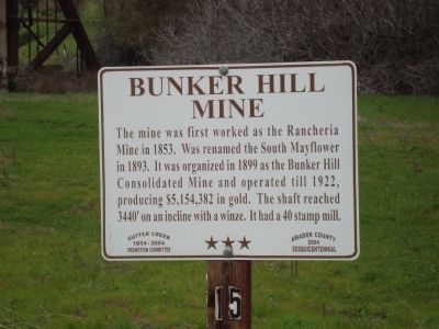
The mine was first worked as the Rancheria Mine in 1853. Was renamed the South Mayflower in 1893. It was organized in 1899 as the Bunker Hill Consolidated Mine and operated till 1922, producing $5,154,382 in gold. The shaft reached 3440’ on an incline with a winze. It had a 40 stamp mill.
Source
Catalogued from the Historical Marker Database (marker No. 44619).