← The catalogue · ← Amador County markers
Gold Country · Amador County
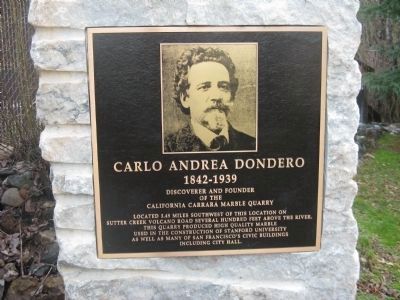
Carlo Andrea Dondero
Other organizationsAmador County
Where it stands
Reached from Main Street, on the left when traveling north; marker is located at the Soldiers Memorial Park, Volcano CA 95689
Coordinates: 38.442167, -120.631167 · View on map →
The words on the plaque
Located 3.49 miles southwest of this location on Sutter Creek Volcano Road several hundred feet above the river. This quarry produced high quality marble used in the construction of Stanford University as well as many of San Francisco's civic buildings including City Hall. (Marker for Carlo Andrea Dondero, 1842-1939, discoverer and founder of the California Carrara Marble Quarry; no erecting organization stated on HMdb page.)
Source
Catalogued from the Historical Marker Database (marker No. 27809).