← The catalogue · ← Amador County markers
Gold Country · Amador County
Chaw Sé Roundhouse
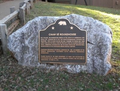
Where it stands
Reached from Pine Grove Volcano Road; marker is within Indian Grinding Rock State Historic Park, between the parking lot and the visitor center, Volcano CA 95689
Coordinates: 38.424817, -120.641233 · View on map →
The words on the plaque
In a village, the roundhouse served as the center of ceremonial and social life. Constructed in 1974, the Chaw Sé roundhouse continues this tradition. With its door facing the east, towards the rising sun, four large oaks are the focal point of this sixty foot in diameter structure. Today, ceremonial roundhouses are the most significant architectural manifestation of the continuing Miwok spiritual heritage. California Registered Historical Landmark No. 1001, an element of the thematic designation, California Native American Ceremonial Roundhouses. Plaque placed by the State Department of Parks and Recreation in cooperation with the Sierra Native American Council and the Chaw Sé Association, October 14, 1974.
Source
Catalogued from the Historical Marker Database (marker No. 8720), cross-checked against the California Office of Historic Preservation’s landmark lists.