← The catalogue · ← Amador County markers
Gold Country · Amador County
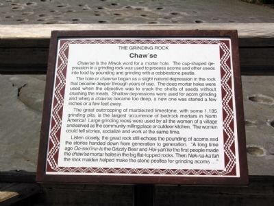
Chaw'se
Where it stands
Pine Grove Volcano Road, 0.3 miles north of Bryson Lane, Indian Grinding Rock State Historic Park, Pine Grove CA 95665
Coordinates: 38.424367, -120.642683 · View on map →
The words on the plaque
Chaw'se is the Miwok word for a mortar hole. The cup-shaped depression in a grinding rock was used to process acorns and other seeds into food by pounding and grinding with a cobblestone pestle. The hole or chaw'se began as a slight natural depression in the rock that became deeper through years of use… The great outcropping of marbleized limestone, with some 1,185 grinding pits, is the largest occurrence of bedrock mortars in North America! (Interpretive marker in Indian Grinding Rock State Historic Park; no erecting organization stated on HMdb page.)
Source
Catalogued from the Historical Marker Database (marker No. 71895).