← The catalogue · ← Amador County markers
Gold Country · Amador County
Hun'ge
Where it stands
Pine Grove Volcano Road, 0.3 miles north of Bryson Lane, Indian Grinding Rock State Historic Park, Pine Grove CA 95665
Coordinates: 38.423900, -120.643567 · View on map →
The words on the plaque
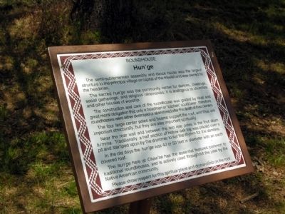
The semi-subterranean assembly and dance house was the largest structure in the principal village or capital of the tribelet and was owned by the headman. The sacred hun'ge was the community center for dances, meetings, social gatherings, and religious ceremonies; it is analogous to churches and other houses of worship… Please show respect for this spiritual place and do not climb on the roof. (Interpretive marker in Indian Grinding Rock State Historic Park; no erecting organization stated on HMdb page.)
Source
Catalogued from the Historical Marker Database (marker No. 71894).