← The catalogue · ← Amador County markers
Gold Country · Amador County
Lancha Plana
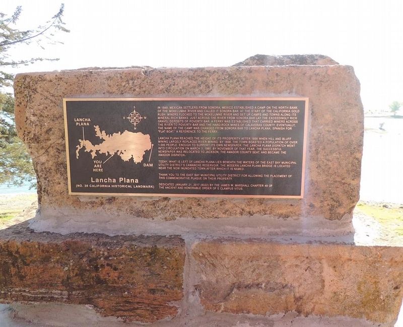
Where it stands
Reached from Camanche Road; located at the Camanche Marina parking lot, Ione CA 95640 post office area
Coordinates: 38.235133, -120.946133 · View on map →
Erected by: James W. Marshall Chapter 49
The words on the plaque
In 1848, Mexican Settlers from Sonora, Mexico established a camp on the north back of the Mokelumne River and called it Sonora Bar. At the start of the California Gold Rush miners flocked to the Mokelumne River and set up camps and towns along its mineral-rich banks. Just across the river from Sonora Bar lay the exceedingly rich gravel deposits of Poverty Bar. A ferry was established that carried miners across the river to Poverty Bar and the hard-rock mines of Calaveras County. Eventually the name of the camp was changed from Sonora Bar to Lancha Plana, Spanish for "flat boat," a reference…
Source
Catalogued from the Historical Marker Database (marker No. 126094), cross-checked against the California Office of Historic Preservation’s landmark lists.