← The catalogue · ← Amador County markers
Gold Country · Amador County
Lincoln Mine
County / LocalAmador County
Where it stands
Intersection of Amador Road and Hanford Street (Old Highway 49) on Amador Road, Sutter Creek CA 95685
Coordinates: 38.397217, -120.806200 · View on map →
The words on the plaque
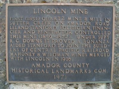
First (1851) quartz mine & mill in Sutter Creek on Amador Road. Leland Stanford financier, politician and benefactor controlled this mine (1859-1872). Under Supt. R. C. Downs it proved a bonanza, aided Stanford to join the builders of the Central Pacific Railroad. Mahoney & Wildman Mines merged with the Lincoln in 1906. Erected 1971 by Amador County Historical Landmarks Commission.
Source
Catalogued from the Historical Marker Database (marker No. 42409).