← The catalogue · ← Amador County markers
Gold Country · Amador County
Moore Mine
County / LocalAmador County
Where it stands
Intersection of Fuller Lane and California Highway 49, on the left when traveling west on Fuller Lane, Jackson CA 95642
Coordinates: 38.337883, -120.760717 · View on map →
The words on the plaque
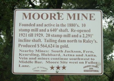
Founded and active in the 1880's. 10 stamp mill and a 640' shaft. Re-opened 1921 till 1929. 20 stamp mill and a 2,291' incline shaft. Tailing dam north to Raley's. Produced $564,624 in gold. Nearby Mines: South Jackson, Fern, Kearsling, Hubbard, Aetna and Anita. Vein and mines continue southwest to Middle Bar. Moore Site west on Fuller Lane. Erected 2004 by Amador County Sesquicentennial Commission.
Source
Catalogued from the Historical Marker Database (marker No. 44582).