← The catalogue · ← Amador County markers
Gold Country · Amador County
Old Eureka Mine
Where it stands
Old Route 49 0.8 miles north of Golden Chain Highway (California Route 49), on the right, Sutter Creek CA 95685
Coordinates: 38.389317, -120.800500 · View on map →
The words on the plaque
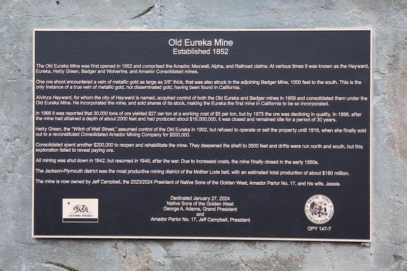
The Old Eureka Mine was first opened in 1852 and comprised the Amador, Maxwell, Alpha, and Railroad claims. At various times it was known as the Hayward, Eureka, Hetty Green, Badger and Wolverine, and Amador Consolidated mines. One ore shoot encountered a vein of metallic gold as large as 3/8" thick, that was also struck in the adjoining Badger Mine, 1000 feet to the south. This is the only instance of a true vein of metallic gold, not disseminated gold, having been found in California. Alvinza Hayward, for whom the city of Hayward is named, acquired control of both the Old Eureka and Badger mines in 1859 and consolidated them under the Old Eureka Mine… Erected 2024 by Native Sons of the Golden West.
Source
Catalogued from the Historical Marker Database (marker No. 240055).