← The catalogue · ← Calaveras County markers
Gold Country · Calaveras County
Fourth Crossing
State landmark (CHL)California Historical Landmark No. 258Calaveras County
Where it stands
State Highway 49, San Andreas; at the fourth crossing of the Calaveras River (San Antonio Creek)
Coordinates: 38.130617, -120.634517 · View on map →
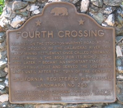
The words on the plaque
Located on the Stockton-Murphy Road at the fourth crossing of the Calaveras River, this early mining settlement, once called Foremans, was famous in the 1850’s for its rich placer ores. Later, it became an important stage and freighting depot and served the Southern Mines until after the turn of the century.
Source
Catalogued from the Historical Marker Database (marker No. 11969), cross-checked against the California Office of Historic Preservation’s landmark lists.