← The catalogue · ← Calaveras County markers
Gold Country · Calaveras County
The Old Corner Saloon
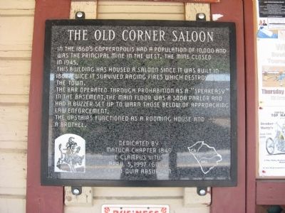
Where it stands
574 Main Street, Copperopolis; marker mounted on the wall to the right of the entrance door
Coordinates: 37.977700, -120.638017 · View on map →
Erected by: Matuca Chapter No. 1849
The words on the plaque
In the 1860’s Copperopolis had a population of 10,000 and was the principal mine in the west. The mine closed in 1945. This building has housed a saloon since it was built in 1862. Twice it survived raging fires which destroyed the town. The bar operated through Prohibition as a “speakeasy” in the basement. The main floor was a soda parlor and had a buzzer set up to warn those below of approaching law enforcement. The upstairs functioned as a rooming house and a brothel.
Source
Catalogued from the Historical Marker Database (marker No. 19770).