← The catalogue · ← El Dorado County markers
Gold Country · El Dorado County
California Stamp Mill
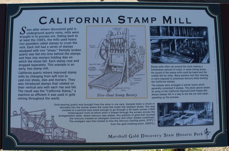
Where it stands
On Coloma Road (California Route 49) north of Mt Murphy Road; resin marker mounted to a metal stand on the Gold Discovery Loop Trail, in front of an example of the California Stamp Mill, Marshall Gold Discovery State Historic Park
Coordinates: 38.800983, -120.892300 · View on map →
The words on the plaque
Soon after miners discovered gold in underground quartz veins, mills were brought in to process ore. Dating back to at least the 1500's, the mills used heavy iron pounders called stamps to crush the rock. Each mill had a series of stamps equipped with iron “shoes.” Partially broken quartz was fed into bins behind the stamps and then into mortars holding dies on which the shoes fell. Each stamp rose and dropped separately. This example is an early, two stamp mill. California quartz miners improved stamp mills by changing from soft iron to cast-iron shoes, dies and mortars… Erected by California Department of Parks & Recreation.
Source
Catalogued from the Historical Marker Database (marker No. 215022).