← The catalogue · ← El Dorado County markers
Gold Country · El Dorado County
Logging in El Dorado County
Where it stands
At the intersection of Pony Express Trail (Lincoln Highway) and Forebay Road, on the right when traveling east on Pony Express Trail; the marker is located at the northwest corner of the Safeway parking lot; marker is at or near 6498 Pony Express Trail, Pollock Pines CA 95726
Coordinates: 38.762783, -120.578000 · View on map →
The words on the plaque
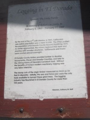
By the end of the war with Mexico in 1847, California's non-native population was a mere 15,000. The 49ers pushed the population of El Dorado County beyond 20,000 by 1850. As winter approached, the minors replaced their tents and shanties with wooden structures… El Dorado County timber provided lumber to develop Sacramento, Placer and Amador Counties, and later to the mining towns of Nevada's Comstock Lode… The stump cuts of the virgin timber measured as much as 23 feet in diameter… Historian: Anthony M. Belli. Sponsored by the Sonke Family. (One panel of the six-sided Pollock Pines kiosk; two of its six markers are missing.)
Source
Catalogued from the Historical Marker Database (marker No. 94634).