← The catalogue · ← El Dorado County markers
Gold Country · El Dorado County
Old Coloma Road
Where it stands
At the intersection of Green Valley Road and Deer Valley Road, on the left when traveling east on Green Valley Road; marker is located in the park adjacent to the Rescue Fire Station; marker is at or near 5221 Deer Valley Rd, Rescue CA 95672
Coordinates: 38.711483, -120.951983 · View on map →
The words on the plaque
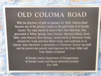
With the discovery of gold on January 24, 1848, Coloma Road became one of the primary routes to the gold fields of El Dorado County. The road started at Sutter's Fort (New Helvitia), then proceeded to Willow Springs (near Folsom), Mormon Island, Green Valley (near Rescue), Rose Springs, turned north at Tennessee Creek, crossed Dry Creek and then Weber Creek, and continued on to Coloma… Erected 2008 by El Dorado County Department of Transportation, El Dorado County and Rescue Historical Societies.
Source
Catalogued from the Historical Marker Database (marker No. 11282).