← The catalogue · ← El Dorado County markers
Gold Country · El Dorado County
Placerville
Where it stands
At the intersection of Coloma Street (State Hwy 49) and Bee Street, on the left when traveling north on Coloma Street, Placerville CA 95667
Coordinates: 38.731800, -120.806633 · View on map →
The words on the plaque
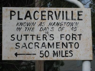
[Marker facing Bee Street] Placerville — Known as Hangtown in the days of “49” — to Sutter's Fort, Sacramento, 50 Miles. [Marker facing Coloma Street–State Hwy 49] Placerville — to — Coloma 8 mi. Where gold was first discovered by James W. Marshall in 1848. Erected 1948. (An El Camino Real bell guidepost placed for the Gold Discovery Centennial; a contributor notes a March 1917 photo already shows the bell, disputing the 1948 date.)
Source
Catalogued from the Historical Marker Database (marker No. 16024).