← The catalogue · ← Nevada County markers
Gold Country · Nevada County
Floriston
E Clampus VitusNevada County
Where it stands
Floriston Way near Interstate 80 (exit 199), on the right when traveling east; at or near 10327 Floriston Way, Floriston
Coordinates: 39.396100, -120.022400 · View on map →
Erected by: Chief Truckee Chapter No. 3691
The words on the plaque
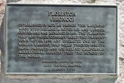
Established in 1872 as Bronco, this railroad wood stop became a noted ice and lumber center and was renamed in 1891. The Floriston Pulp and Paper Company built the present town after 1899 and operated one of the world's largest pulp mill through 1930. It paper products and ice helped California's agricultural industry feed the hungry of the world.
Source
Catalogued from the Historical Marker Database (marker No. 105206).