← The catalogue · ← Nevada County markers
Gold Country · Nevada County
Ormonde
Where it stands
Maybert Road, 3.5 miles east of Washington (beyond the Canyon Creek Bridge), at the Golden Quartz Picnic Ground; at or near 18289 Maybert Road, Washington CA 95986
Coordinates: 39.359900, -120.748883 · View on map →
Erected by: Wm. Bull Meek – Wm. Morris Stewart Chapter No. 10
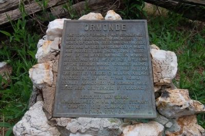
The words on the plaque
The town of Ormonde was established here in 1887. Downstream, across the mouth of Canyon Creek was Canyonville 1850, and upriver approximately 4 miles was Maybert 1886. These towns were part of the Upper Washington Mining District and were the furthest upstream of the serious mining ventures along the South Yuba. During its brief history the district yielded 17 million dollars in gold, but by 1897 it was nearly totally abandoned. The remains have since been obliterated by flooding. Erected 1990 by E Clampus Vitus, Wm. Bull Meek – Wm. Morris Stewart, Chapter No. 10.
Source
Catalogued from the Historical Marker Database (marker No. 43678).