← The catalogue · ← Nevada County markers
Gold Country · Nevada County
Pioneer Emigrant Trail
Native Sons/DaughtersNevada County
Where it stands
East Broad Street, Nevada City; at or near 632 East Broad Street, Nevada City CA 95959
Coordinates: 39.267000, -121.021917 · View on map →
The words on the plaque
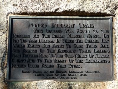
This boulder was known to the pioneers as the Indian Medicine Stone. On its top are hollows in which the Indians lay while taking sun baths to cure their ills. One branch of the Emigrant Trail leading from Truckee Pass to the gold mines of Nevada County and to the Valley of the Sacramento passed close beside this stone. Tablet placed by the Historic Landmarks Committee, Native Sons of the Golden West. Dedicated Oct. 18, 1936.
Source
Catalogued from the Historical Marker Database (marker No. 37121).