← The catalogue · ← Nevada County markers
Gold Country · Nevada County
Rough and Ready
Where it stands
Intersection of Rough and Ready Highway and Mountain Rose Road, Rough and Ready
Coordinates: 39.229383, -121.138817 · View on map →
The words on the plaque
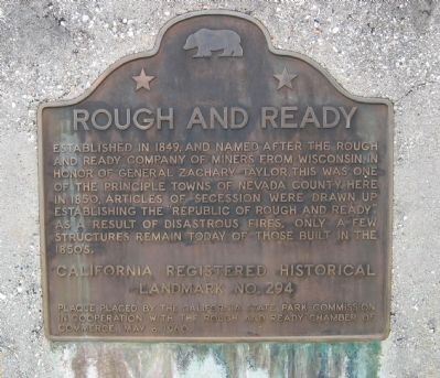
Established in 1849 and named in honor of General Zachary Taylor, after the Rough and Ready Company of miners from Wisconsin, this was one of the principal towns of Nevada County. In 1850, articles of secession were drawn up establishing the 'Republic of Rough and Ready.' As a result of disastrous fires, only a few structures remain today that were built in the 1850s. California Historical Landmark No. 294.
Source
Catalogued from the Historical Marker Database (marker No. 10560), cross-checked against the California Office of Historic Preservation’s landmark lists.