← The catalogue · ← Placer County markers
Gold Country · Placer County
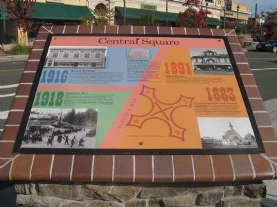
Central Square
Where it stands
On Lincoln Way (State Highway 49) near High Street, on the right when traveling north; at or near 972 California 49, Auburn CA 95603
Coordinates: 38.898733, -121.070867 · View on map →
The words on the plaque
Central Square: After the Central Pacific Railroad built a Train Depot, over a mile away and up the hill from Old Auburn, civic leaders looked for a way to connect the two areas. The city planners took a map and located a halfway point between the Placer County Court House and the East Auburn Train Depot. Over time, this spot became known as Central Square, as it is today. When concrete sidewalks first appeared circa 1905 in Central Square the halfway point was defined by a medallion referenced in legal descriptions for this block of properties, has survived many years of sidewalk repairs and is surprisingly still there today. Can you find the medallion?… (Multi-panel interpretive marker; further panels cover the 1916 Masonic Building, 1918 Armistice Day, the 1891 Opera House and the 1883 First Congregational Church.)
Source
Catalogued from the Historical Marker Database (marker No. 52312).