← The catalogue · ← Placer County markers
Gold Country · Placer County
Roads and Bridges
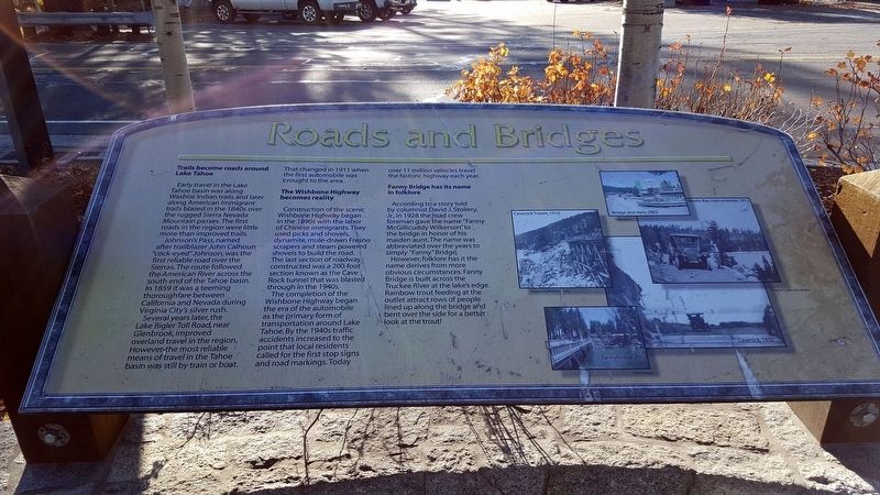
Where it stands
On W Lake Blvd, on the right when traveling north (post office area: Tahoe City CA 96145)
Coordinates: 39.167150, -120.144483 · View on map →
The words on the plaque
Partial transcription — the catalogue holds only part of the inscription, kept as found
Trails become roads around Lake Tahoe. Early travel in the Lake Tahoe basin was along Washoe Indian trails and later along American immigrant trails blazed in the 1840s over the rugged Sierra Nevada Mountain passes. The first roads in the region were little more than improved trails. Johnson's Pass, named after trailblazer John Calhoun "cock-eyed" Johnson, was the first reliable road over the Sierras. The route followed the American River across the south end of the Tahoe basin. In 1859 it was a teeming thoroughfare between California and Nevada during Virginia City's silver rush.… Erected by North Lake Tahoe Historical Society.
A note on this marker
One of the William B. Layton Park / Gatekeeper's Cabin Museum panel cluster at the Lake Tahoe outlet in Tahoe City; the panels stand within a few steps of each other at near-identical published coordinates but are distinct markers, not duplicates.
Source
Catalogued from the Historical Marker Database (marker No. 112967).