← The catalogue · ← Placer County markers
Gold Country · Placer County
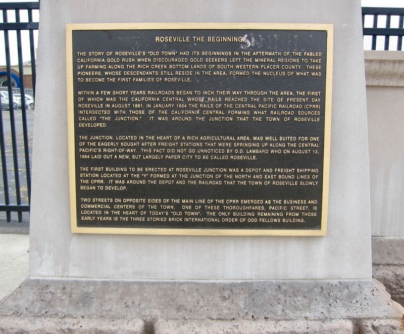
Roseville The Beginning
Where it stands
At the intersection of Main Street and Washington Boulevard, on the left when traveling west on Main Street (post office area: Roseville CA 95678)
Coordinates: 38.751833, -121.286967 · View on map →
The words on the plaque
Partial transcription — the catalogue holds only part of the inscription, kept as found
The story of Roseville's "Old Town" had its beginnings in the aftermath of the fabled California gold rush when discouraged gold seekers left the mineral regions to take up farming along the rich creek bottom lands of south western Placer County. these pioneers, whose descendants still reside in the area, formed the nucleus of what was to become the first families of Roseville. Within a few short years railroads began to inch their way through the area, the first of which was the California Central whose rails reached the site of present day Roseville in August 1861. In January 1864 the rails of the Central Pacific Railroad (CPRR) intersected with those of the California Central forming what railroad sources called the junction.…
A note on this marker
Stands immediately beside the Incorporation panel (m=135430); distinct panels of the Old Town Roseville history display, not duplicates.
Source
Catalogued from the Historical Marker Database (marker No. 135429).