← The catalogue · ← Tuolumne County markers
Gold Country · Tuolumne County
Don Pedro Lake
Where it stands
On State Highway 49/120, on the right when traveling north. Marker is located at the north end of the dam 3.75 miles south of Chinese Camp
Coordinates: 37.844383, -120.381483 · View on map →
The words on the plaque
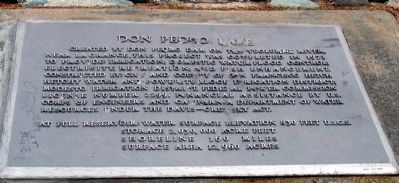
Created by Don Pedro Dam on the Tuolumne River near LaGrange. This project was completed in 1971 to provide irrigation, domestic water, flood control, electricity, recreation and fish enhancement. Constructed by City and County of San Francisco Hetch Hetchy Water and Power, Turlock Irrigation District, Modesto Irrigation District, Federal Power Commission, License Number 2299. Financial assistance by U.S. Corp of Engineers and California Department of Water Resources under the Davis-Crumsky Act. At full water surface - elevation 830 feet U.S.G.R. Storage - 2,030,000 acre feet. Shoreline -160 miles. Surface area -12,960 acres.
Source
Catalogued from the Historical Marker Database (marker No. 13199).