← The catalogue · ← Tuolumne County markers
Gold Country · Tuolumne County
Jacksonville
Where it stands
At the intersection of Jacksonville Road and River Road, on the right when traveling south on Jacksonville Road; at or near 12659 Jacksonville Road, Jamestown
Coordinates: 37.839000, -120.346917 · View on map →
The words on the plaque
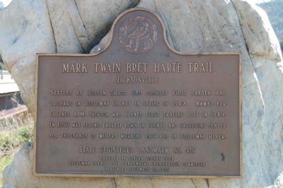
Settled by Julian Smart who planted first garden and orchard in Tuolumne County in spring of 1849. Named for Colonel A.M. Jackson who opened first trading post in 1849. In 1850 was second largest town in county and gathering center for thousands of miners working rich bed of Tuolumne River. Erected 1950 by Sonora Rotary Club and Tuolumne County Gold Centennial Committe [sic]. (Mark Twain Bret Harte Trail plaque for California Historical Landmark No. 419; a second, distinct CHL 419 plaque stands near Don Pedro Dam — see the other Jacksonville record. The town site is now submerged by Lake Don Pedro.)
Source
Catalogued from the Historical Marker Database (marker No. 53523), cross-checked against the California Office of Historic Preservation’s landmark lists.