← The catalogue · ← Tuolumne County markers
Gold Country · Tuolumne County
Scraping the Rocks Clean
Where it stands
On Columbia Street, in the gold panning demonstration area of Columbia State Historic Park, just north of the south parking area off of Columbia Street
Coordinates: 38.033683, -120.400483 · View on map →
The words on the plaque
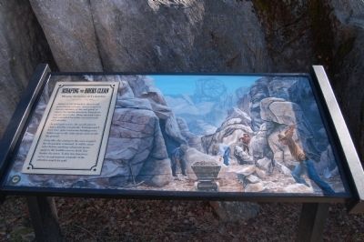
Mining Activities at Columbia. Armed with pickaxes, shovels and powerful jets of water miners, removed massive amounts of dirt and gravel to expose the marble limestone formations you see here today. Deep open-pit mines once extended for miles east and south of Columbia. As gold grew scarce, the search moved closer, into the community. Townspeople's lives were upset and many buildings torn down to get to the shiny metal underneath the ground. Long after the mining in this area stopped, the devastation remained. It will be many years before anything substantial grows again in the boulder-strewn fields that border the town. Today this limestone serves as a permanent reminder of the relentless search for gold. (Columbia State Historic Park interpretive marker.)
Source
Catalogued from the Historical Marker Database (marker No. 53306).