← The catalogue · ← Tuolumne County markers
Gold Country · Tuolumne County
Trails and Waterfalls
Where it stands
Reached from Hetch Hetchy Road, at O'Shaughnessy Dam, Hetch Hetchy Reservoir
Coordinates: 37.947650, -119.787883 · View on map →
The words on the plaque
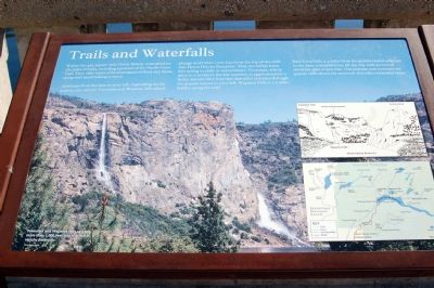
Within this 459-square-mile Hetch Hetchy watershed are 287 miles of trails, including a portion of the Pacific Crest Trail. They offer views of an abundance of flora and fauna, along with breathtaking scenery. Upstream from the dam to your left, depending on the season, you can see the Tueeulala and Wapama falls which plunge more than 1,000 feet from the top of the cliffs into Hetch Hetchy Reservoir. They are fullest from late spring to early or mid summer. Tueeulala, which dries to a trickle in the late summer, is approximately a thirty-minute hike from the dam after you pass through the granite tunnel to your left. Wapama Falls is 2.5 miles farther along the trail. Rancheria Falls, 5.4 miles from the granite tunnel adjacent to the dam, is an ambitious all-day trip with an overall elevation of 900 feet. This popular trail traverses the granite cliffs above the reservoir and offers beautiful vistas. (Hetch Hetchy interpretive panel.)
Source
Catalogued from the Historical Marker Database (marker No. 1943).